

Aitlang River - the Lifeline of Vairengte
River Aitlang – may not be found in the river map of Mizoram. Still, this small hill stream at Vairengte has a fascinating story woven into the local history with the forest of native fruit trees, elephant herds, and hunters! It is also the lifeline of people of this border town at the northern tip of the Kolasib district and the gateway to the land of ‘Blue Mountain’!
Mizos identify this stream as Kawrthindeng, while the Hmars, a sub-group of the Mizo tribe, fondly call it ‘Aitlang,’ derived from a native fruit known as ‘elephant apple.’
Years ago, Mizo elders say, the entire foothill forests along the Cachar-Mizoram boundary were covered with elephant apple trees (Dillenia indica) and thick bamboo groves. These ever-green forest areas were the favorite forage grounds of wild elephant herds. The passing elephants devoured the fallen, juicy yellow-green fruits of these trees. That’s how, perhaps, these native wild fruits came to be known as ‘elephant apple’!
“And since these elephant apple fruit trees used to be found abundantly along with the river catchment areas,” locals at Vairengte suggest, “the hill stream may have got its name after the native fruit tree - aitlang.”
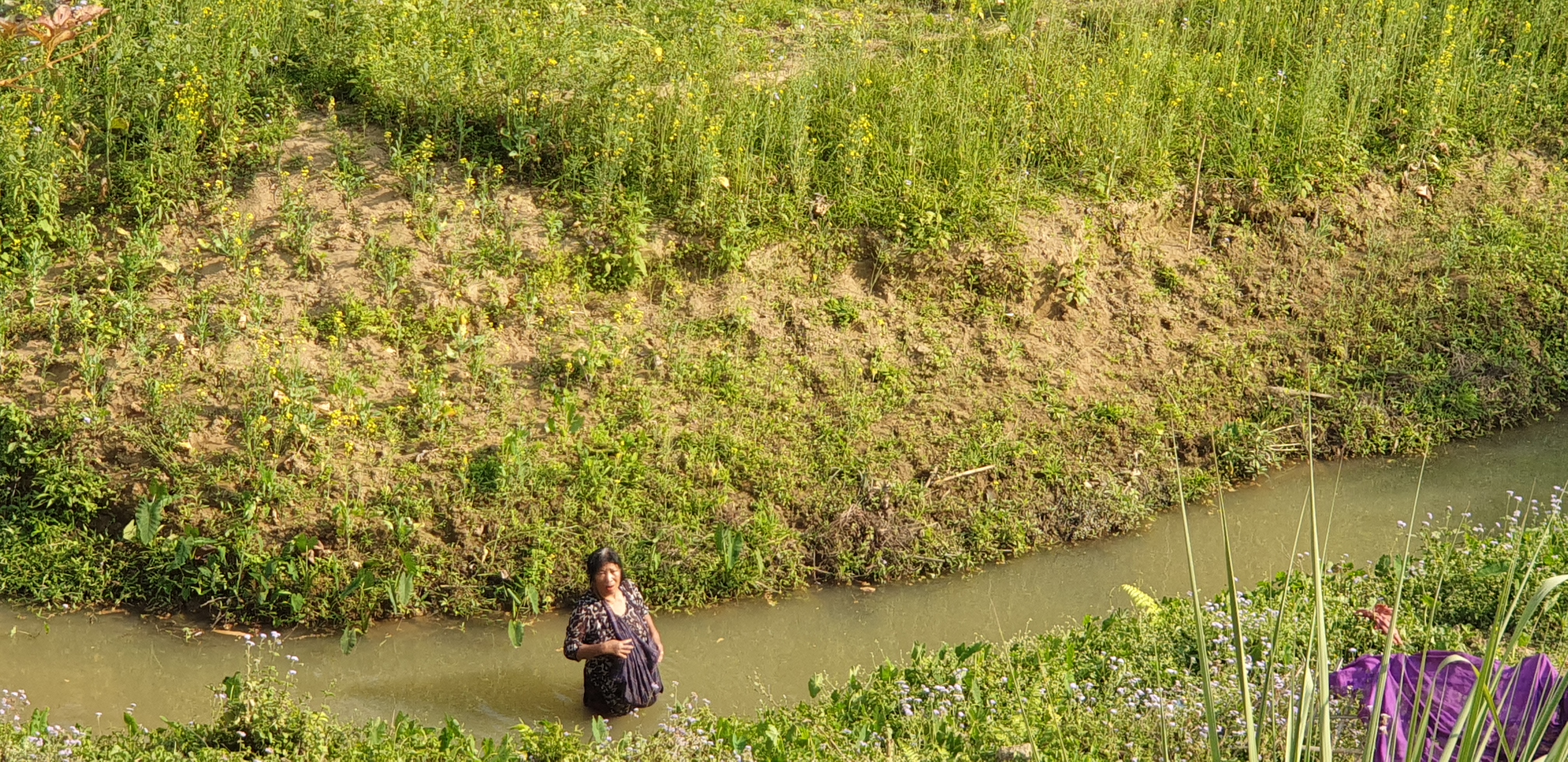
Aitlang River, one may call it a Stream!
There are also local stories of brave elephant hunters, who would venture out in those areas for laying out traps close to these fruit trees along the river catchment forest. There were plenty of elephant apple trees in those days; a few of these fruit trees are found even now along the river banks. Apart from these fruit trees, there were also many Banyan trees all over the places at Vairengte, which provided shelter to different birds and squirrels etc., and recreation for local people.
Originated in one of the hills around Vairengte, Aitlang flows along the western side of the town, gradually rolling down toward north through the foothills to the Cachar plains in southern Assam; from there it assumes a new name, Rukni, before joining another north-flowing river, Tuirial, on the eastern side of Kolasib after it enters the Cachar district, where the river is known as Sonai. Along the way, it also gathers waters from several other hill streams flowing out of Mizoram.
“In olden days,” recollects Robert Hrangmana, president of Mizo Upa Pawl (Mizo Elders Association) of Vairengte area, “foothills along the Aitlang stream were ideal spots for hunters as there was hardly any village or human settlement in the Cachar side of the inter-state boundary, which was also an important wildlife corridor. The thick reserve forests used to be teeming with wild animals – elephant, leopard, deer etc.” Over the years, he said, the whole landscape began to change with rapid increase of population, including influx of illegal migrants from Bangladesh. Long tracts of foothills forest began to disappear within a very short period. The destruction of river catchment forest along the Aitlang river adversely affected the hydrological system, causing depletion of water flow from the streams and drying up of natural springs.
Hrangmana also pointed out that the foothills forest governance was weak due to the raging dispute between Mizoram and Assam over the ownership and control of the tract claimed by both the governments. Mizo farmers found it difficult to continue farming on the bank of the Aitlang river, he said.
The pristine past of Aitlang
By its present condition, size, and flow it may hardly be called a river anymore. But decades ago, elders say, “it was a sparkling river, much wider, about 25 feet or more, flowing gently along the forested hill slopes in the Vairengte areas.” There were plenty of fish, crab, water snail, and prawn found in the river, and its banks were covered with bamboos and thick forest.
The natural environment of Vairengte, with its rich forests, natural springs, and streamlets, offered a hospitable climate. It used to be quite warm in the summer and cold in dry winter months; neither hot nor cold, an ideal temperature. On the hot summer days, villagers, especially young boys and girls, would rush to the river and plunge into the clear waters of Aitlang. Some would look for crabs and snails. It was a widespread practice among the students to quietly slip away from school and go swimming instead of attending the noon shift. The river water was used for drinking and all other household works.
Local people also had good knowledge of many edible plants, roots, and other non-wood products like herbs, wax and honey, which they would collect from the nearby natural forest. Therefore, both the forest and streams were the source of sustenance for many. Even though much of its charm has faded now, “Aitlang remains an integral part of our daily life and local history,” said an elder at Vairengte.
Urbanization & population growth
Once a sleepy, nondescript hamlet of few families, Vairengte shot to limelight with the establishment of Counter-Insurgency and Jungle Warfare School (CIJWS) in the wake of Mizo armed insurrection in the late Sixties, much to the chagrin of the local population. However, this military station has emerged as one of the best guerrilla training centers in Asia in the past decades. The CIJWS now offers training in complex high-intensity guerrilla warfare and holds regular war games with the world’s top armies almost every year. Its presence has also triggered a slew of infrastructure development around Vairengte – all weather road, electricity and connectivity etc., linking the state capital Aizawl with Assam and the rest of India. Not only that, it created employment and other economic opportunities for the local population of the surrounding areas, as well as provided other services such as, access to army canteen, banking, contract and supplies works.
Over the years, with the availability of better amenities, Vairengte witnessed a steady growth of population and expansion of urban settlement, including government offices, schools, health care centers, post offices and private businesses. According to the 2011 Census Report, Vairengte, which has now been upgraded to one of the three civil sub-divisions under the Kolasib district, has a population over 10,500 people. At least 70 per cent of the local population is engaged in agriculture, horticulture and other allied activities such as, areca nut and broom grass plantations on the hill slopes. Some of the farmers have paddy fields and fish ponds, while some others still depend on traditional jhum cultivation.
Naturally, all these activities have raised demand for more water. Much of the water needs of the households and private and government establishments as well as the military station (CIJW School), which houses over a thousand of army men, officers, and other personnel, are met from the Aitlang stream. The entire military establishment requires daily supply of at least 2.5 lakh litres of water throughout the year. The Public Health Engineering Department (PHED) of Mizoram, which has set up a composite water supply project at Vairengte by using the waters of Aitlang, is responsible for uninterrupted supply of water to the military station and to the households of the entire sub-division.
Changing Ecology
Though most of Mizoram is blessed with abundant rainfall, natural springs, and perennial streams, most rainwater is drained out due to hilly terrain conditions. Also, the local rainwater harvesting efforts have not been adequate to secure water needs for all. Natural springs, another primary water source in such hilly terrains, get depleted very fast as soon as the monsoon retreats. Thus, in the dry winter months, Vairengte faces an acute water crisis like other hilly regions.
Says Hrangmana: “The water situation is worsening by days with a steady rise of population, spread of urbanization and deterioration of natural environment due to improper and unsustainable land-use practices leading to widespread soil loss and land degradation.” All this is also adversely affecting the natural flow of the hill streams, especially Aitlang.
Local elders say some of the main factors responsible for the depletion of water sources are:
First of all, in the name of development and raising income, the government introduced large-scale plantations of commercially attractive trees, mostly teak, all along the state highway and the surrounding hill slopes. Under this program, many local farmers were engaged for teak plantation; they were told teak plantation would fetch them good economic returns. During the past 25 years or so, this massive plantation drive was singularly responsible for large-scale deforestation in the area, as the thick natural forests were cut down to the roots. Villagers soon figured out the damage this monoculture did to the catchment areas, as many natural springs and streamlets began to dry up. Not only that, those who took up the government-sponsored scheme for teak plantation with the hope of making some good money were not allowed to fell trees, following the Supreme Court restriction on logging. The long-term consequences of monoculture plantation turned out to be bad for both the natural environment and local economy.
Secondly, even as the shifting cultivators were always blamed for deforestation, soil loss, and land degradation, none of the alternative land-use solutions worked for the poor and marginalized farmers. Instead, these so-called commercial crops did more harm than any good to them. For example, under the New Land Use Policy (NLUP), the state government encouraged farmers to take up broom grass cultivation on their Jhum plots, which are said to have good markets in the plains. This flagship program was launched in 2011. Thousands of families got financial assistance to develop agriculture, fishery, etc. Around 500 families of Vairengte had taken up broom grass cultivation as they got some benefits.
As mentioned earlier, Vairengte is close to the inter-state junction of Hailakandi and Cachar districts of southern Assam and Mizoram. It has emerged as a thriving trading center connecting the markets of the hill state and the plains. Taking advantage of its location, farmers in the Vairengte areas have started planting broom grass on the river banks and its catchment areas for commercial purposes. To get better growth of broom grass plants, farmers regularly burn their fields, which have virtually been turned into a semi-desert. And this practice of burning is going on despite its adverse effects on forest regeneration, water conservation, and ecological balance.
Another factor that has caused much concern is conflict-related migration to the Vairengte area and its associated pressure on land, water, and other natural resources. In the past decades, there has been a tremendous expansion of town areas following the influx of Mizo migrants from some parts of Assam and Manipur. Due to the clashes, a Mizo group took shelter in Vairengte. During the 1990s, these awakened confrontations between Kukis (Mizo) and Nagas. At the beginning of the millennium, there were severe problems between the Hmar (Mizo) and the Dimasa tribes of the North Cachar Hills in Assam. Many Hmar people fled their villages and settled mainly in Vairengte town.
The town and village authorities had to accommodate the victims of ethnic conflict on humanitarian grounds. They allowed these migrants to settle in the nearby areas of the Aitlang river without any impact assessment or adequate resource planning. The migrants had to survive on whatever they could get out of the given land and its resources. Large catchment areas were cleared for building houses and river side farming.
New Challenges & way forward
Today, Aitlang is facing an existential crisis – its water quality has deteriorated due to pollution and is not fit for consumption without treatment. It has also lost much of its vigor and flow, setting off serious concern over the future water availability for the growing population.
So what should be done?
Local authorities need to engage with the community leaders to address the looming problems and challenges, and discuss ways to find solutions. Traditionally, Mizos have strong social and community institutions – YMA & Church and a proven culture of working together in dire straits.
This calls for immediate attention to address the following:
i) Restoration of natural forests and catchments that ensure supply of pure water.
ii) Reclamation of degraded lands, soil health, and microorganisms that help support our food, fuel, and fiber needs, and medicinal plants and natural herbs for health care.
iii) Adoption of better land-use practices that help us improving natural environment and management of natural resources.
iv)Vigorous efforts in rainwater harvesting by digging trenches or pits in the catchment areas.
v) Government must invest in community-led decentralized water management activities and provide financial, scientific, and appropriate technological back up to implement such projects; and finally, sustained civic actions would be necessary to create awareness among the villagers and people in general about the importance of conservation of water, and the intricate relationship among soil, water, and forest.